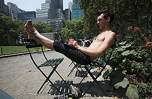
Bryant Park, New York, 2010
A walk through New York City's Bryant Park is a walk through time. Designed during the Great Depression on the site of a former reservoir and executed under the leadership of Parks Commissioner Robert Moses, the park was inspired by French classicist gardens. Its gravel paths in the shade of London Plane trees suited the rhythm of life in pre-air-conditioned New York. Today the park, which sits behind the great main branch of the public library, has cafes, entertainment, a reading library, lawn games — all amenities tuned to contemporary urban life.
One of the most important amenities, though, is invisible. A cloud of wifi hovers over the park, bringing activities that Moses, a truly ambitious urban planner, could not have imagined. Those trees that shaded city-dwellers out for a stroll decades ago now keep the glare off touch screens. And despite the fears that mobile communication technology would drive us all into lives of wireless isolation, the opposite seems to be happening. Bryant Park, like myriad parks and plazas in other cities, is returning to a role it filled generations ago: a place to share, read, write, gossip, and debate...in short, communicate.
Technology has always shaped the city, changing our relationship to time, space, nature and each other, but today's technologies are so small it's hard to see how that happens. Yet ubiquitous data and information communication technologies (ICT) such as smart-phones, tablet computers, and digital books, are changing the way we interact with the built environment and our fellow citizens.
What does it mean for the future of our cities that technology is an integral part not only of design and construction but of the user experience? What does it mean for a city to learn from and respond to the users of its public spaces? These were some of the questions raised at the recent Intelligent Cities Forum at the National Building Museum. The Forum, a component of the year-long Intelligent Cities Initiative, brought together researchers, design and planning professionals, public health experts, and representatives from all levels of government for a day of conversation focusing on the challenges and opportunities that information and communication technologies (ICT) pose for cities.
The success of the rejuvenated Bryant Park raises familiar questions for designers and planners. What exactly are the essential ingredients of a great urban space? Can they be measured? In 1980, influential urbanist William Holly Whyte published The Social Life of Small Urban Spaces, a meticulous study of how people used open space in the city. Whyte, who had been involved for more than a decade in the comprehensive plan for New York, wondered if all the parks and plazas were actually performing the way the architects and planners assumed they would. So he began to watch people. And film them. It was a radical project at the time, as no one had done any systematic research on how people actually used the spaces designed for them. Why were some brand new plazas empty while people crowded into others?
Whyte used film because it was the only medium capable of capturing time and motion, critical information in understanding any dynamic environment. Now, smart phones allow you to see when the next bus is arriving, where the closest coffee shop is located, and to track afternoon thunderstorms. Time and space together carry a lot of information about a city, and geospatial visualization lets us see characteristics of our cities that used to be invisible. ICT give us new ways to document and study urban spaces to better understand how to improve them. Moreover, those same technologies in the hands of the public are changing how those spaces are used.