

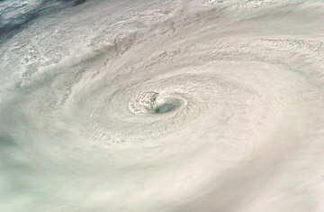
The eye of Category 4 Hurricane Dean, in the Caribbean, as seen from the space shuttle Endeavour, Aug. 18, 2007
El Niño, that meteorological trickster with the deceptively innocent name, wreaks havoc on the world's weather. Caused by an unusual warming of the eastern Pacific Ocean, El Niño can trigger storms, droughts and other weather disturbances around the planet, drying out normally wet areas and flooding dry parts. But there is a positive effect to El Niño: it tends to reduce the number of hurricanes forming in the Atlantic Ocean. El Niños produce stronger vertical wind shear — the difference in wind speed and direction over a short distance — in the Atlantic, which inhibits the production of hurricanes.
On average, hurricanes in the U.S. have caused about $800 million in damage annually during El Niño years, half the damage caused during the reverse event, La Niña.
But according to a study published in the July 3 Science, El Niño is changing — and that could mean more hurricanes for the already battered western Atlantic coast. Climatologists led by Peter Webster at Georgia Tech found that in some El Niño years, the ocean warming associated with the event is moving thousands of miles west, to the center of the Pacific Ocean. Called El Niño Modoki (after the Japanese term meaning "similar, but different"), the new El Niño seems to shift Atlantic cyclones to the west, resulting in more frequent storms and more hurricanes making landfall on the coast of the Gulf of Mexico and Central America. Because many climatologists believe that climate change is also strengthening the storms that form, a hotter future could be one with hurricanes that are both more powerful and more common.
Japanese and Korean researchers were the first to notice the El Niño Modoki phenomenon, before its possible effect on hurricanes really snapped into focus in 2004. That was an El Niño year, which led experts to predict a lighter than average Atlantic hurricane season. But it instead to turned out to be an El Niño Modoki, and overall hurricane activity was 2½ times as severe as normal, with 15 named storms and six major hurricanes. Florida was repeatedly battered. "We had a lot more storms than we expected, and that got us thinking," says Webster.
As Webster explains it, the thousands of miles of westward shift of Pacific Ocean warming seen during an El Niño Modoki essentially shifts the Atlantic hurricanes westward as well. "It's as if you had a big aquarium with a Bunsen burner below it," he says. "The heat causes a rising and sinking motion in the water. If you shift the position of the burner, you shift the motion of the water too." The El Niño Modokis also result in reduced vertical wind shear and therefore promote the creation of hurricanes. (When vertical wind shear is too strong, it can tear storms apart before they can fully form.)
It's not clear why the Pacific warming seen in El Niño events is shifting west. It's possibly part of a long-term but natural oscillation, like the decades-long cycles that already affect hurricanes. "The second possibility is that it's an impact of global warming," says Webster, who will continue exploring the question at Georgia Tech. Either way, with the climate warming and El Niño changing, the future is likely to be stormy for the western Atlantic — which is bad news for everyone but hurricane researchers with a new puzzle to solve. "Those are the games we're going to play," says Webster. "It's going to be fun."